Stop What You’re Doing and Come Check Out This Phenomenal Time Lapse of Amarillo
Okay, so I'm still not sure how I managed to accidentally find this, but I don't like to look the gift horse in the mouth--SO.....let me give a little context, set the stage, all that jazz.
It's part of my job to find interesting things around me. And it's also part of my job to dig around until I find these interesting things. However, I was definitely not digging around for anything interesting at all when I stumbled across this gem that I'm about to show you.
I was knee-deep in a comment thread somewhere in a Facebook group when I saw someone mention that Google Earth would likely have a aerial/satellite images taken between a certain span of years. Now, I know all about Street View and the ability to toggle between the older and current views there....
But Google Earth? Aight, time for me to jump on in. I didn't find it right away, so I had to google (googleception?) Long story short, there's a project out there that will show satellite imagery as a timelapse.
Bingo. Next step: Amarillo.
The result? NEAT.
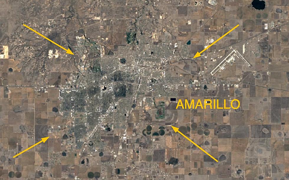
Check out this timelapse of Amarillo, satellite-style. I selected the years 1984 to present and set the speed for x.25 for playback pleasure.
Don't be shy, zoom in! You won't be able to zoom in all the way, but it's pretty bleepin' cool at any distance.
I found that I experienced maximum "wow" factor when dragged the map over to the city outskirts and zoomed in as closely as possible....then pressed play.
I know that cities are just doing what cities do when they grow--but it's always something else when the city in question is the one you live in. It's amazing to reflect on how much Amarillo has changed, and how much it will continue to change. What will this timelapse look like ten years from now?
Only one way to find out!
Can You Guess These Towns From Their Satellite Photos?
Teeny Tiny Towns of the Texas Panhandle
More From 98.7 The Bomb
![[UPDATE] Massive Amarillo Street Pothole Already Has Improvements](http://townsquare.media/site/179/files/2024/04/attachment-IMG_3489.jpg?w=980&q=75)


![[CLOSED] Another One Bites the Dust – Amarillo Location Closes](http://townsquare.media/site/179/files/2024/04/attachment-Untitled-design-11.jpg?w=980&q=75)


![[PHOTOS] Amarillo Home with Addams Family Connection For Sale](http://townsquare.media/site/179/files/2024/04/attachment-Untitled-design-1.jpg?w=980&q=75)
